


For many abroad who are tracing their Irish roots, a return to Ireland begins with a county name. Yet long before surnames were recorded in parish books, the land itself determined how families lived. Rainfall patterns, soil quality, coastline access, and upland terrain shaped not only farming methods but also marriage choices, inheritance customs, and migration decisions.
Geography did not merely frame Irish history. It directed it.
Understanding this reality transforms Irish ancestry research from a collection of names into a lived narrative grounded in place.
The Land Before the Record
The earliest agricultural communities in Ireland adapted to geography with precision. The distribution of early settlements, influenced by the movements of the Celtic tribes in Ireland, followed fertile river valleys and defensible hills rather than modern county lines.
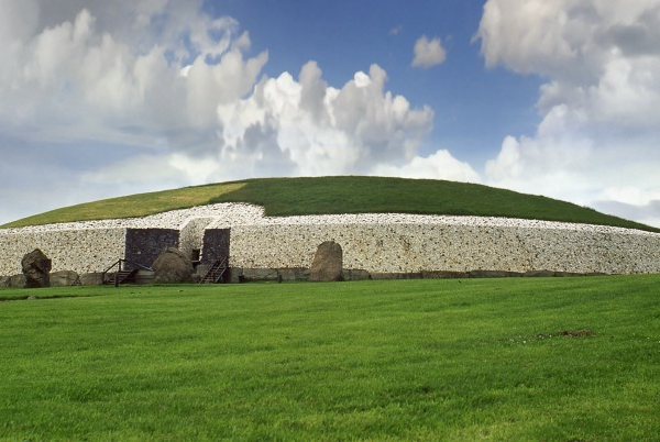
In areas such as what is now associated with County Meath, rich pastureland encouraged cattle farming and estate consolidation. By contrast, the rugged terrain central to Clare, Ireland fostered smaller holdings and seasonal grazing systems.
Even today, those researching Donegal, Ireland genealogy or exploring detailed Donegal family history quickly discover that the Atlantic climate shaped subsistence patterns in ways that influenced generations.
Geography created constraints. Families adapted accordingly.
Farming Systems and Inheritance
In eastern Ireland, including much of Meath and Wexford, relatively stable soil conditions supported mixed farming. Families researching Wexford, Ireland genealogy, often encounter structured inheritance patterns tied to tillage land.
Meanwhile, in western counties such as Mayo and Clare, poorer soil quality meant heavier reliance on the potato crop by the eighteenth century. This agricultural dependence directly influenced later patterns of Irish potato famine immigration.
Research into deeper exploration of Mayo family genealogy frequently uncovers evidence of land subdivision. Holdings became smaller with each generation, particularly where multiple sons required portions of the same homestead.
In contrast, upland regions linked to County Cavan or Tyrone, Ireland reveal patterns of livestock farming and seasonal labour that shaped household economics differently.
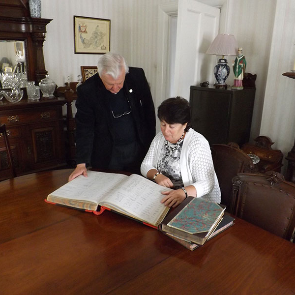
Professionals offering genealogy services in Ireland do not simply identify land plots. They examine valuation records and estate papers to understand why land passed in a certain way and how that affected family decisions.
Marriage, Weather, and Community Boundaries
Marriage choices in rural Ireland were rarely romantic abstractions. They were practical responses to geography. In regions with fragmented farmland, marriage often required careful negotiation to maintain viable holdings.
Families associated with County Monaghan or Armagh, Ireland genealogy may find evidence of inter-parish marriages designed to consolidate adjacent land parcels. Geography shaped who married whom.
Heavy rainfall in Atlantic counties created different seasonal rhythms compared with the comparatively sheltered east. Agricultural calendars influenced courtship, market gatherings, and even religious observance.
When researching genealogy in Ireland, parish registers frequently reveal clusters of surnames concentrated within specific townlands. These patterns reflect geographic realities more than coincidence.
Similarly, genealogy in Ireland requires attention to how terrain and plantation-era settlement structured communities differently. Effective Ireland genealogy research entails collaboration with a specialist genealogist in Ireland, particularly where land tenure systems differed from those in the Republic.
Geography and Famine
The dependence on the potato crop in western counties was not merely cultural. It was environmental. The crop thrived in marginal soils where grain would not.
When blight struck in the 1840s, geography magnified vulnerability. Coastal and western communities suffered disproportionately. Archival material documenting the Irish Famine shows that entire townlands in counties such as Mayo and Clare were emptied.
Research into Irish potato famine immigration frequently reveals chain migration patterns tied to specific parishes rather than entire counties. Families from the same townland often settled together abroad.
For descendants researching County Galway genealogy in Brisbane, it is common to find that famine-era departures were concentrated within a single rural district shaped by geography and crop failure.
Understanding these patterns requires more than consulting the so-called best genealogy sites in Ireland. It demands contextual archival work that connects climate, land, and demographic change.

From Archive to Landscape
At My Ireland Family Heritage, research does not end with documentation. As the only company offering both comprehensive research and heritage travel under one roof, the journey moves from paper to place.
Each client receives a carefully prepared keepsake manuscript that explains how land, weather, and geography influenced their ancestors’ decisions.
From there, our immersive family history tours and thoughtfully paced ancestry travel tours, guided by certified tour guides, allow descendants to stand within their ancestral townland and understand the environmental realities that shaped it.
Even broader history tours of Ireland gain new meaning when seen through the lens of geography and family adaptation.
Plantation Geography and Borderland Realities
Geography also shaped political settlement. Nowhere is this more evident than in Ulster. The plantation system introduced new landholding patterns across what is today associated with Ireland genealogy, fundamentally altering community structure.
In areas connected to Tyrone and Armagh, estate boundaries often divided traditional Gaelic landholdings. Families were relocated, surnames shifted across parish lines, and agricultural practices adapted to new tenancy agreements. The terrain itself influenced settlement clusters, with fortified estates placed strategically within defensible landscapes.
Researching genealogy in Ireland demands attention to these geographic overlays. Parish registers alone rarely tell the whole story. Estate papers, tithe applotment books, and valuation maps reveal how landscape and policy intersected.
This is why structured Ireland genealogy research often benefits from consultation with a specialist genealogist in Ireland who understands how geography shaped record survival.
Coastal Counties and Maritime Migration
Ireland’s coastline shaped migration as profoundly as its soil shaped farming. In counties such as Wexford and Donegal, maritime trade routes influenced departure patterns long before the famine years.
Those tracing Wexford, Ireland genealogy frequently uncover shipping records and seasonal fishing connections that predate nineteenth-century emigration. Likewise, families researching Donegal family history often encounter labour migration tied to Scotland and coastal Britain.
Western counties were shaped by exposure to Atlantic weather. Isolation in certain districts influenced delayed marriage patterns, communal reliance, and seasonal labour. Geography dictated opportunity.
Meath and Clare: A Study in Contrast
To understand the influence of geography fully, one might compare Meath and Clare.
County Meath
Inland pastureland and proximity to Dublin encouraged estate consolidation and relative agricultural stability. Families connected to County Meath, Ireland genealogy, often find multi-generational landholding continuity. Parish boundaries were closely tied to productive farmland.
Marriage alliances frequently aimed to maintain viable holdings rather than expand marginal plots.
County Clare
In contrast, the limestone landscape of Clare demanded adaptation. Families associated with Clare, often relied on mixed subsistence farming. The Burren’s terrain influenced seasonal grazing and communal cooperation.
When famine struck, Clare’s environmental vulnerability amplified hardship. Examination of Irish Famine workhouse facts reveals how geographic exposure influenced relief patterns.
These regional contrasts remind us that genealogy is never abstract. It is environmental history lived at family level.
Geography as the Key to Meaningful Travel
For those tracing their Irish roots, walking the land without context can feel incomplete. A coastline is beautiful, yet its significance deepens when one understands that its storms once determined survival.
At My Ireland Family Heritage, archival research connects landscape with lived experience. As the only company offering both detailed research and immersive heritage travel under one roof, families are guided from documentation to destination.
Our immersive family history tours and reflective ancestry travel tours, led by certified tour guides, allow descendants to see not only where their ancestors lived but why they lived there.
Broader history tours of Ireland gain new resonance when shaped by geography rather than convenience.
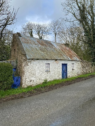
Each family receives a carefully prepared keepsake manuscript, grounding their journey in evidence before they step into their ancestral townland.
Climate, Faith, and the Parish Centre
In rural Ireland, geography did not operate in isolation. It worked in concert with faith. The parish church was rarely positioned at random. It was built where communities could gather despite rivers, bogland, and upland barriers.
For families researching genealogy in Ireland, parish boundaries often follow natural contours: rivers, ridgelines, or fertile valleys. These geographic divisions influenced baptismal records, marriage registers, and burial grounds.

In Atlantic counties such as those central to Clare, weather patterns shaped weekly rhythms. Winter storms delayed travel. Summer markets strengthened community ties. These cycles influenced marriage timing and agricultural labour.
Similarly, those exploring Donegal, Ireland genealogy, frequently find that rugged terrain fostered tightly knit local networks. Parish life became the anchor of stability in regions where weather could be unpredictable.
Understanding how climate shaped worship patterns and communal life allows descendants to read parish records with greater clarity.
Land Pressure and Late Marriage Patterns
One of the most significant effects of geography was its influence on marriage age. In regions where holdings were small and soil quality limited expansion, sons often delayed marriage until land became available.
Research connected to Mayo family genealogy frequently reveals later marriage ages compared to eastern counties. Land pressure meant consolidation rather than subdivision after the famine.
In contrast, families tied to County Meath, Ireland genealogy sometimes demonstrate earlier marriage ages due to comparatively stable estate structures.
This demographic nuance is often overlooked when relying solely on digital databases. The so-called best genealogy sites in Ireland list dates. They rarely explain why those dates occurred when they did.
Geography provides the explanation.
Weather Events in the Archival Record
Extreme weather events occasionally appear in estate correspondence and parish notes. Floods, failed harvests, and livestock disease outbreaks are recorded not merely as local incidents but as catalysts for migration.
Those engaged in deeper Ireland genealogy research may encounter estate records from Tyrone, Ireland genealogy or Armagh, Ireland genealogy describing crop failures or rent arrears following particularly harsh winters.
Such entries illuminate why a family disappeared from one parish and appeared in another.
In certain regions connected to Wexford, Ireland genealogy, coastal storms influenced fishing communities and seasonal employment. Weather altered economic opportunity and therefore altered family decisions.
When descendants return to these landscapes through guided family history tours, seeing the terrain first-hand transforms abstract record entries into lived understanding.
Geography and Surname Clustering
Irish surnames often cluster within specific geographic pockets. These concentrations were rarely accidental. Natural barriers such as mountains, lakes, and bogland limited movement for generations.
Families researching Donegal family history frequently discover surname continuity within defined valleys. In parts of Ulster, including areas tied to Ireland genealogy, estate settlement patterns reinforced these clusters.
This phenomenon also appears in diaspora studies. Those tracing County Galway genealogy in Brisbane often uncover chain migration patterns reflecting tight geographic origin.
Professional genealogy services in Ireland examine not just individuals but communities, analysing how surnames interacted within environmental constraints.
Walking the Landscape with New Eyes
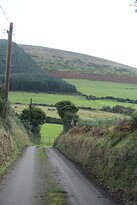
When archival research explains how rainfall shaped crops or how limestone terrain limited pasture, the physical landscape becomes a document in itself.
Standing on a windswept coastal ridge in Clare or observing the sheltered pastureland of Meath reveals why ancestors made the choices they did.
Through carefully structured ancestry travel tours and regionally grounded history tours of Ireland, descendants begin to interpret geography as their forebears once did.
Certified tour guides contextualise terrain, climate, and land use, allowing families to connect environment with decision-making.
At My Ireland Family Heritage, the integration of documentary research and guided heritage experience ensures that geography is not merely admired. It is understood.
Geography Continues to Shape Identity
The landscapes that shaped Irish ancestors continue to shape Irish identity. Farming practices, parish loyalties, and migration memories are rooted in land and weather.
For those committed to Irish ancestry research, recognising geography as an active force rather than a scenic backdrop deepens interpretation. It transforms genealogy from lineage tracing into environmental history.
Ireland’s rivers, coastlines, boglands, and hills influenced who stayed, who married, and who left. They shaped Irish potato famine immigration patterns. They determined where homesteads stood and why certain townlands endured.
To understand your ancestors fully is to understand the weather they endured and the land they cultivated.
Frequently Asked Questions
Why does geography matter in Irish genealogy?
Geography explains farming systems, inheritance practices, migration timing, and marriage alliances. It provides context that parish registers alone cannot.
How does this apply to Ireland research?
In genealogy in Ireland, plantation settlement patterns, estate divisions, and land tenure systems shaped family movement. Geographic awareness clarifies record interpretation.
Can weather really influence family decisions?
Yes. Rainfall patterns, soil quality, and exposure to Atlantic storms influenced crop reliance, particularly before and during famine years.
Is visiting my ancestral county enough?
A county visit provides orientation. Visiting a specific townland, informed by documented research, creates meaningful reconnection.
Why combine research and travel?
Research establishes certainty. Travel restores presence. Together, they transform curiosity into lived understanding.
Begin Your Journey with Context
Ireland’s weather, rivers, coastlines, and soil shaped every generation before us. They influenced who married, who stayed, and who departed. To understand your lineage fully is to understand the land that formed it.
My Ireland Family Heritage invites you to begin your own journey of discovery, connecting archival evidence with the landscapes that shaped your ancestors’ decisions.
Let your heritage be explored not merely through names, but through the geography that gave those names meaning.